Hiking in Mallorca from Palma: Best Trails, Maps & How to Plan
Palma as Your Trailhead
From the heart of Palma to the soul of Mallorca. Base in the city and you’re 20–70 minutes from most headline routes in the Serra de Tramuntana and along the coast. We pair early starts with coffee at Plaça d’Espanya, then use Ma-11 for the northwest (Valldemossa, Deià, Sóller), Ma-13 for Lluc/Massanella, or Ma-19 for southeast coastal walks.
🥾 Best Hikes Near Palma
| Trail | From Palma (drive) | Time | Grade | Why it’s special |
| Camí de s’Arxiduc (Valldemossa) | ~25–35 min (Ma-1110) | 3–4 h | Moderate | Historic ridge path with huge sea/mountain views |
| Cala Deià ↔ Llucalcari ↔ Sóller (section) | ~35–45 min (Ma-11) | 3–4 h | Moderate | Coastal stone paths, coves, olive terraces |
| Castell d’Alaró | ~30–40 min (Ma-13) | 2.5–3 h | Moderate | Castle ruins, panorama, easy to combine with lunch |
| Torrent de Pareis (Sa Calobra) | ~70–90 min (Ma-10) | 5–6 h | Hard | Mallorca’s canyon epic; dry conditions only |
| Puig de Massanella | ~60–70 min (Ma-13) | 4–6 h | Hard | High-peak day with island-wide views |
| Cap de Formentor coastal section | ~70–80 min (Ma-13) | 2–3 h | Easy-Mod | Dramatic cliffs and lighthouse vistas |
| Mondragó Park coast path | ~55–65 min (Ma-19) | 2–3 h | Easy | Pine shade, beaches and protected coves |
Grades consider good footwear, water and summer heat management.
🧭 Getting There from Palma
Drive:
- Northwest (Valldemossa/Deià/Sóller): Ma-11, 25–45 min.
- Lluc/Massanella/Torrent: Ma-13 → Ma-2130/Ma-10, 60–90 min.
- Southeast (Mondragó): Ma-19 → Santanyí, 55–65 min.
Public transport:
- Train + vintage tram options to Sóller; TIB buses to Valldemossa/Deià/Sóller/Lluc vary by season and time of day. See Public Transport in Mallorca and Palma to Sóller Train for step-by-step planning.
Parking tips: arrive before 09:30 in peak months; carry coins/apps for blue-zone villages.
🗺️ Interactive Map Pins (start points)
Save these to your phone and tap “Directions” in Google Maps on the day. Drive times are from Palma Cathedral in normal traffic; arrive before 09:30 in peak months for easier parking.
Valldemossa – Camí de s’Arxiduc Trailhead
Classic ridge loop with instant Tramuntana drama. Anti-clockwise is kinder on the legs; pack a wind layer for the crest.
| Feature | Info |
| From Palma | ~25–35 min (Ma-1110) |
| Parking | Signed village car parks (paid/blue-zone) |
| Notes | Cobbled starts; shade early, exposed on top |
Alaró – Castell d’Alaró Start
Steady climb through pines to panoramic castle ruins. Great shoulder-season hike, easy to pair with a late lunch in town.
| Feature | Info |
| From Palma | ~30–40 min (Ma-13 → Alaró) |
| Parking | Village lots/streets; respect access signs |
| Notes | Final section rocky; bring grip and water |
Sa Calobra – Torrent de Pareis Entry
Mallorca’s canyon epic. Attempt only in dry, settled conditions; expect boulders, easy scrambles and variable footing.
| Feature | Info |
| From Palma | ~70–90 min (Ma-10 via Sóller/Lluc) |
| Parking | Paid areas near Sa Calobra (fills fast) |
| Notes | No shade; 2–3 L water/person; plan exit/transport |
Mondragó Natural Park – Coastal Loops
Pine-shaded family paths linking Cala Mondragó and S’Amarador with benches and viewpoints—perfect for a swim-and-stroll day.
| Feature | Info |
| From Palma | ~55–65 min (Ma-19 → Santanyí) |
| Parking | Signed park car parks (paid in season) |
| Notes | Waymarked; bring reef-safe sunscreen, water |
🌄 Featured Routes (Short Notes You Can Scan)
Camí de s’Arxiduc – Valldemossa Ridge Views
Stone-set balcony paths built by Archduke Ludwig Salvator. Choose an anti-clockwise loop for gentler climbing, and pack a wind layer for the exposed crest.
Cala Deià ↔ Llucalcari ↔ Port de Sóller (section)
Olive terraces, cobbled steps and turquoise coves; the coastal variant has summer shade and swim options. Watch for polished stones after dew.
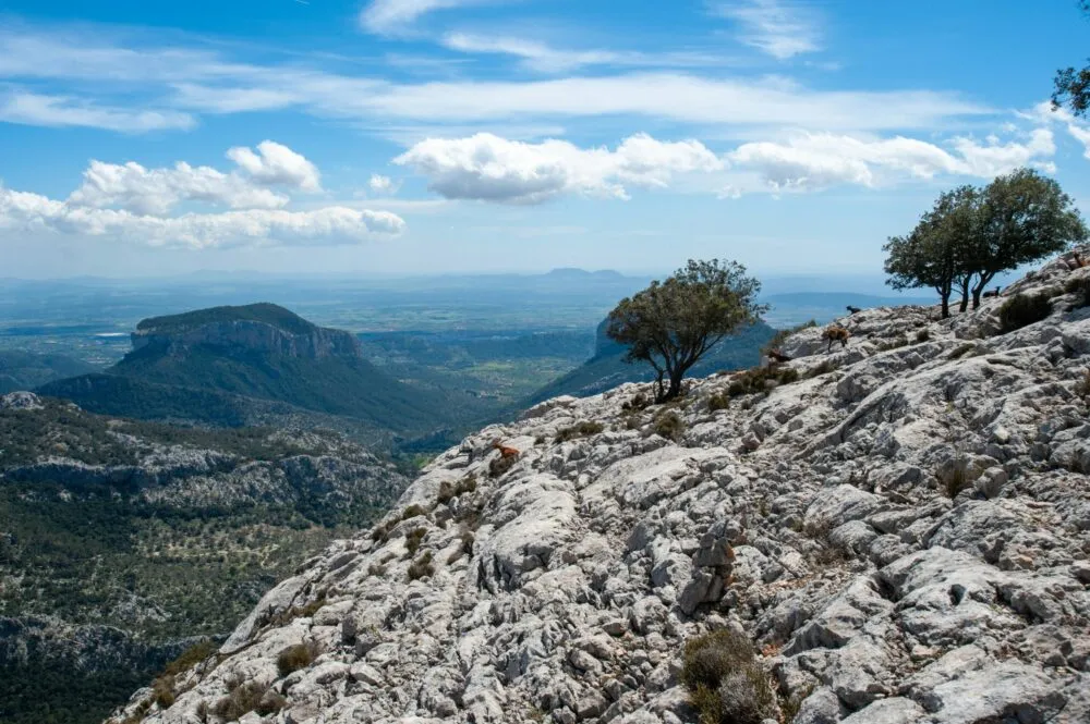
Castell d’Alaró – Ruins & Views
Farm tracks, pines and a final rocky pull to the castle and Es Verger area (roasted lamb fans take note). Great shoulder-season hike.
Torrent de Pareis – The Canyon Epic
Only in settled, dry conditions. Expect boulder hopping, some easy scrambles and a long day. Stage a two-car plan or check seasonal Sa Calobra buses.
Puig de Massanella – High Ground
Mallorca’s second-highest summit day. Respect heat and carry 2–3 L water; weather can turn quickly at altitude.
Mondragó Natural Park – Easy Coastal Loops
Family-friendly trails linking Cala Mondragó and S’Amarador with benches and viewpoints. Great plan after a Palma morning.
🧳 What to Pack (Keep It Light but Smart)
- Footwear: trail shoes or light boots with grip
- Water & electrolytes: 1.5–3 L depending on route/heat
- Sun/heat: hat, reef-safe sunscreen, light long sleeves
- Nav: downloaded offline maps (phone) and a paper back-up on big days
- Safety: small kit (blister care), headtorch outside midsummer, whistle
About GPX: a GPX file is a simple track you can load into phone apps/watches for turn-by-turn breadcrumbs offline. We like it for long or poorly waymarked routes.
📅 When to Hike (Weather & Crowds)
| Season | Daytime highs | What to expect | Our take |
| Mar–May | 16–24 °C | Green hills, mild temps | Prime for long days |
| Jun–Aug | 27–33 °C | Hot; early starts essential | Aim for shade/shorter routes |
| Sep–Oct | 23–28 °C | Warm sea, fewer crowds | Sweet spot for coast + peaks |
| Nov–Feb | 14–19 °C | Crisp ridges; short days | Great for castles & ridge loops |
Start before 08:30 in July–August; carry extra water.
🦺 Safety, Access & Respect for the Tramuntana
Mallorca’s trails cross private fincas, heritage walls and posidonia-fed watersheds. Stay on waymarked paths, close gates, and take litter home. Summer brings heat stress; turn around if you or anyone in your group stops sweating or feels dizzy.
Key reminders
- Check wind and canyon conditions before Torrent de Pareis days.
- No drones in protected zones without permits.
- Wildfire risk: no open flames; use signed picnic areas only.
❓ FAQ
How do I choose between Valldemossa, Deià and Sóller?
Valldemossa for ridge views, Deià for coast + coves, Sóller for train combo and orange-grove valley.
Is Torrent de Pareis suitable for kids?
Not recommended unless they’re experienced scramblers and conditions are dry. Try Castell d’Alaró or Mondragó instead.
Can I do a GR-221 section as a day hike?
Yes. Pick Valldemossa ↔ Deià or Sóller ↔ Deià for classic stone paths and easy transport.
Do I need permits for peaks?
Massanella uses private access controls that can change; check at trailheads or with local info boards.
Are there water sources on trails?
Rare and seasonal. Carry what you need and refill in villages after.
🔒 Related Guides
- Best Hiking Trails in Mallorca
- Serra de Tramuntana, Mallorca
- Discover Mallorca’s Natural Parks
- Public Transport in Mallorca
- Palma to Sóller Train
- What to See in Mallorca
- Road Trips in Mallorca – The Ultimate Guide
- Best Beaches in Mallorca
- Hidden Beaches of Mallorca – 12 Secret Calas